Some Russian commanders used 20th-century maps when invading Ukraine.
The press service of the SBU office in the Kharkiv region said this on Facebook, Ukrinform reports.
"Investigators of the Security Service of Ukraine established that some of the Russian commanders who invaded our territory in February were guided by topographical maps of Ukraine from 1969. This is evidenced by the documents of the invaders, which the SBU seized in the districts of the Kharkiv region temporarily occupied by the Rashists," the report says.
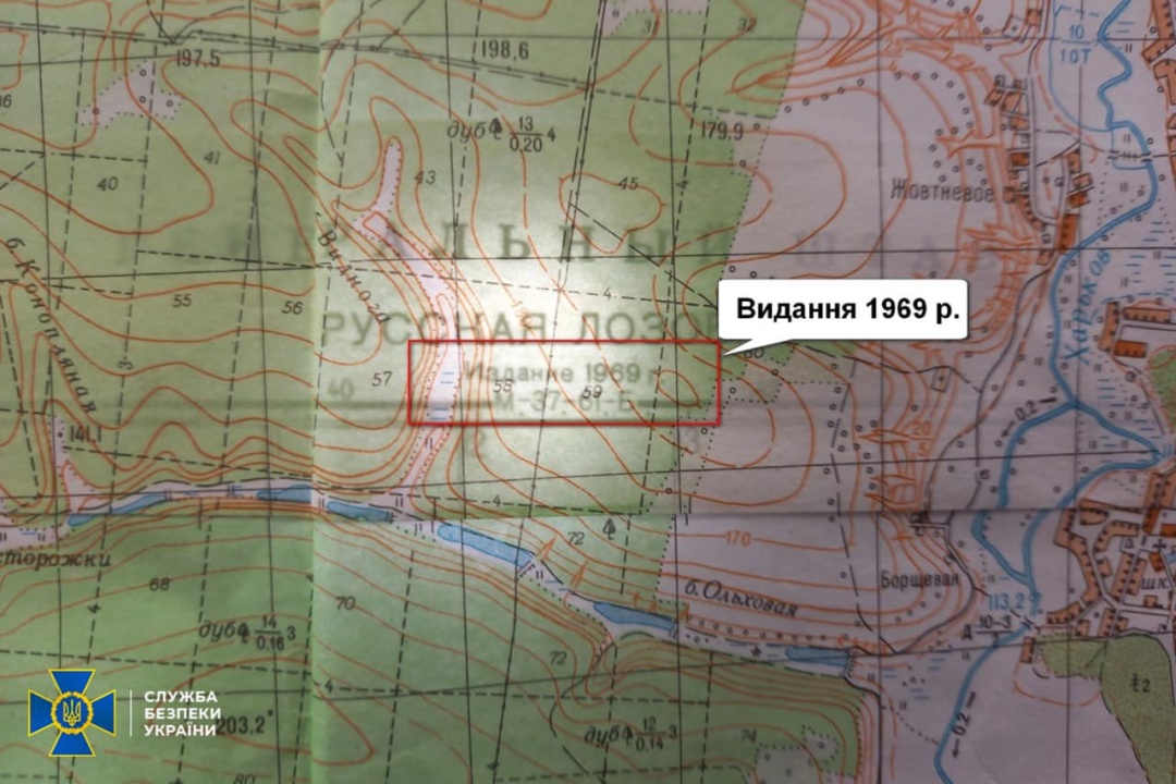
According to the report, information on the documents of the Russian motor rifle battalion of the 138th Guards Motor Rifle Brigade was not updated for at least 53 years.
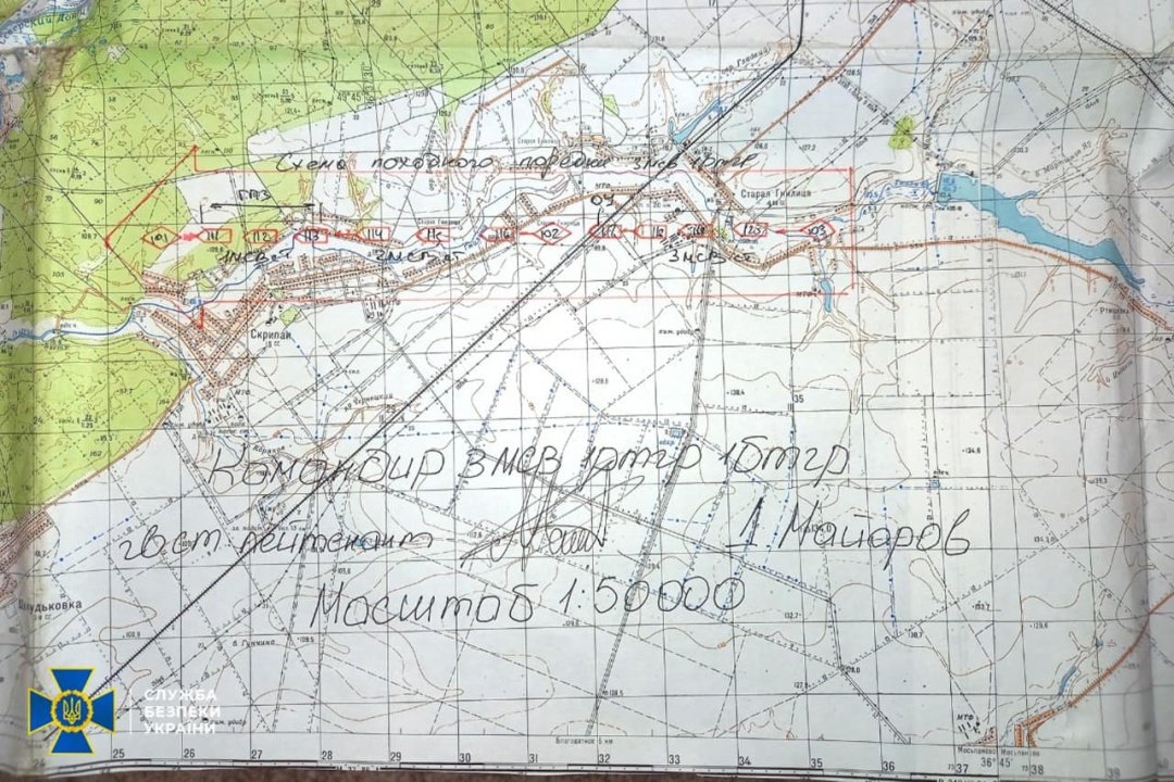
"On the maps of the occupiers, the Saltivsky residential area of Kharkiv, which was built up since the beginning of the 1970s, is completely missing. The Travianske and Muromske reservoirs, built in the 1970s, are also missing. And the state border between Ukraine and Russia is drawn with a ballpoint pen, as it was not on the maps at all," the report said.