Ukrainian border guards rescue 16 crew members after Russian drone hits foreign cargo ship in Black Sea
Ukraine’s new military leadership vows stronger strikes and technological advantage over Russia
Rubio to discuss Russia's war against Ukraine at meeting with Lavrov
ლევან ხაბეიშვილი: „ბრძოლაა საჭირო და არა პროფესორ-კომენტატორობა“
დიპლომატიურ კორპუსს ე.წ. საბოტაჟის საქმეზე სასამართლო პროცესზე დასწრების უფლება არ მისცეს
მიხეილ სააკაშვილი - სრულიად სამარცხვინოდ „ქართულმა საერთაშორისო გამჭვირვალობამ“ არ შემიყვანა პოლიტპატიმართა სიაში
საიას თავმჯდომარე: ვახო სანაიას „ფეისბუქ-პოსტის“ გამო პატიმრობა დემონსტრაციული, სამაგალითო დასჯაა
გოჩა მირცხულავა: აქ „XXX“ არავინ არის. ანუ თუ ვახო სანაიას საქმეში კონტექსტია მთავარი, მაშინ მოდით, კონტექსტზე ვისაუბროთ...

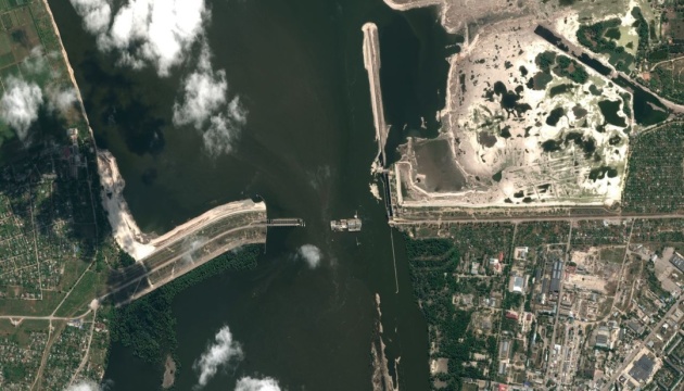
Maxar releases new satellite imagery of destroyed Kakhovka HPP

ნახვები: 536 Maxar releases new satellite imagery of destroyed Kakhovka HPP
Maxar Technologies has released the latest satellite imagery of the Kakhovka HPP destroyed by Russian troops.

The photos show the dam destroyed by the Russian occupiers and the flooded surroundings.
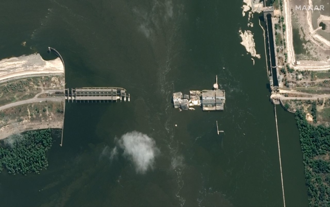
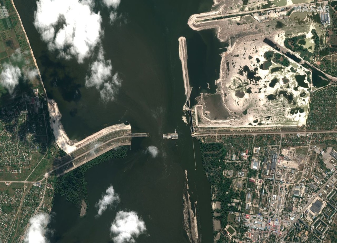
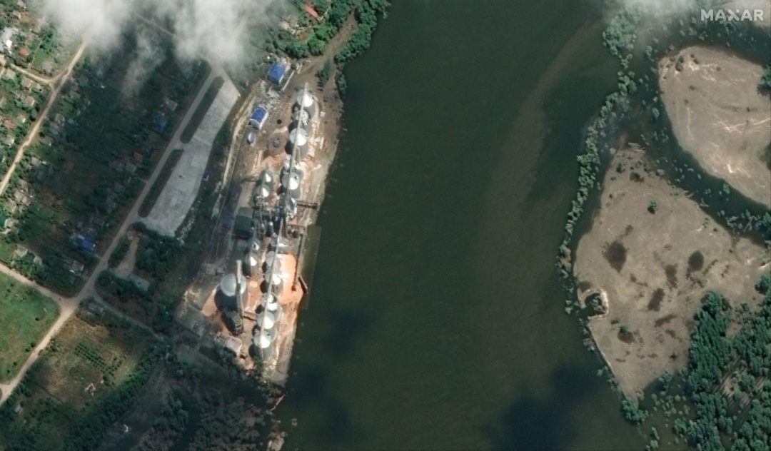
One of the pictures also shows the Nibulon river terminal in the urban-type village of Kozatske, not far from the blown-up hydroelectric power plant.

Earlier, the terminal was completely flooded, but the latest satellite images indicate that the water level has begun to decrease.
As reported, on the night of June 6, Russian troops blew up the dam of the Kakhovka HPP, causing large-scale flooding of the territories of Kherson region. Part of Mykolaiv region was also affected by flooding. In Zaporizhzhia and Dnipropetrovsk regions, the water level in the Dnipro River has decreased.

Read also: Kakhovka HPP explosion: 54 settlements in three regions remain flooded

In particular, in Zaporizhzhia, as of June 16, the water in the lower bay fell by 3.75 meters. Now its level is one meter lower than normal.

Photos: Maxar Technologies

ყველას ნახვა
ყველას ნახვა
ყველას ნახვა
ყველას ნახვა
ყველას ნახვა